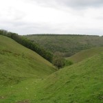
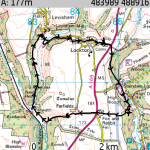
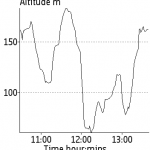
The starting point for this circuit is just outside the village of Lockton about 5 miles north of Pickering. Map OS Explorer OL27 North York Moors Eastern area, ref. 847899. I would recommend that the route be followed clockwise, the views looking down the way we went were great and the wooded valleys were a good way of climbing afterwards. It would have been a bit tedious going the other direction.
On the stretch of road between the A169 and the village of Lockton, there is a convenient grass verge for parking, although if there’s a cricket match on, you might need to park on the road towards the village.
The verge is kept mowed by the parish council and is also used as the parking area for the cemetary opposite. Try to park at right angles to the road to avoid taking up more space than necessary, although I’d be careful not to get stuck in case it’s muddy.
The route of the walk is east across the A169 then diagonally south across a field into the wooded Thornton Dale. You need to be a little careful at Staindale Lodge, the path turns right, over a stile and up the hill, you need to ignore the tempting looking gate ahead of you, that just takes you through somebody’s garden. Luckily that somebody was there to turn us around and correct us.
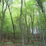
Head up the hill to the track then you’ve got a couple of options. You need to follow the valley South a bit yet, so either go up and then take a track on the left, or go down and turn right just before the other end of aforementioned garden. Continue over grassland beside a stream, then, past a bridge, follow signs to the right uphill through a wood, then across fields to the back of the Fox and Rabbit pub.
The Fox and Rabbit looks like to be quite a comprehensive enterprise. Walking towards it from the woods gave quite a good progression from ‘countryside’ to ‘tourist’. It started off with a few fields with horses and jumps, then a working farmyard, then a camping and caravan ground before finally the pub’s courtyard with what looked like a couple of rooms at the back. Not sure if they were for tourists or for the staff, but you couldn’t fault the location. The footpath ran down the side of the pub, outside the kitchens. The lunchtime service smelt very tempting indeed. Oh, and the pub’s sign was for Black Sheep. What a combination. However, it was only about midday at this point and we had to press on.
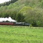
Cross the A169 into a lane and after about 500 yards, continue straight on rather than following the lane to a farm. Descend through a valley in a field of sheep and on reaching almost level ground, turn right alongside a field boundary. To the left, on the far side of the field, is the North York Moors Railway. If you’ve done your homework beforehand, you can get an idea of when the steam trains will be running past you. The trains whistles and chuff-chuff-chuffings can be heard from quite a way away, so you shouldn’t be taken too much by surprise when they emerge from the trees. You can get a very good view of the tracks from the path, but for the true enthusiasts there’s a level crossing slightly further on.
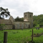
In about ¼ mile follow the track to the left towards a farm and the level crossing, then look for a sign to the right over a substantial wooden footbridge. Cross the bridge and continue to the right across a field following the stream into a valley. Continue near the bottom of the left side of the valley just below the edge of a wood. Continue for about a mile, you will see a church in the valley.
St Marys Church used to serve both Lockton and Levisham, but it fell out of use in the mid 1950s and was officially declared obsolete in the early 1970s. The roof had long since departed, the Yew trees looked ancient and some of the gravestones date back years, but there was at least one dated 2000 and something, so I’m guessing the ground is still consecrated. The sheep did a reasonable job of maintaining the grass around the stones. The council put up a concise information board for tourists like us to read about it.
Pass the church then turn sharp right down a path alongside the church to a bridge over the stream. Turn right slightly uphill and after about 100 yards turn sharp left onto a track that leads to a road. On reaching the road, turn right then immediately right again onto a path up a steep hill through the woods to a seat and then on into the west end of Lockton village. Continue through the village back to the starting point.
There are two lunch options, both run by the same people. There’s the Fox and Rabbit pub on the main road, which caters towards the higher end of the tourist lunch market (Main Courses only) and there’s The Horseshoe pub at the far end of Levisham which has main courses (3 meat roast, 1 fish, 1 vegetarian, 1 pie) and lighter options such as sandwiches.
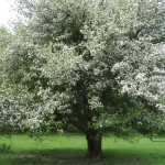
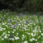
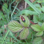
Half the fun of walking with a group of work colleagues is that there’s normally at least one expert for any situation, be it estimating the number of rings on a tree (80-90), summarising the economic benefit of the North York Moors railway (300,000 passengers, an extra £30m spent by tourists), discussing the risks to the British Bluebell by it hybridising with a Spanish one or bringing forth the entomologist to identify a particularly red and black bug thing sat on a leaf (not a beetle)
As ever, the full trip details are available to dig through on Everytrail:
